
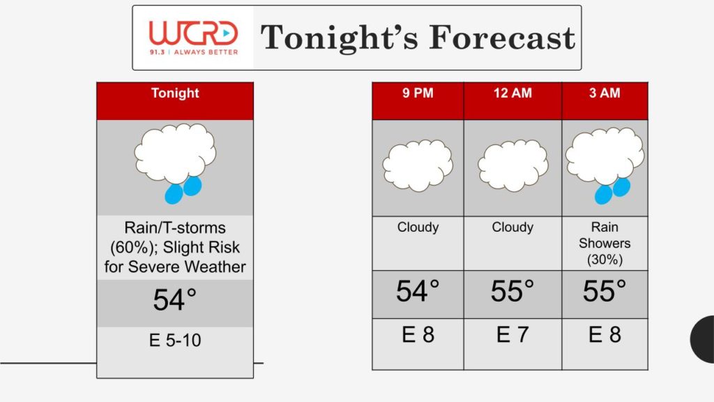
Tonight: We are expecting a a chance of more rain showers to move into the area and afterwards bringing cloudy and overcast. Some showers can get heavy at times. Delaware county currently under a flash flood watch. On top of the rainy conditions, those winds will be strong, gusting up to 20 mph. So its going to be a cold, windy night ahead. Also tonight, we can see a warm front slowly start to approach and the pass the area late tonight into the early mornings tomorrow. This warm front is going to be the setup for severe weather that is expected for tomorrow.
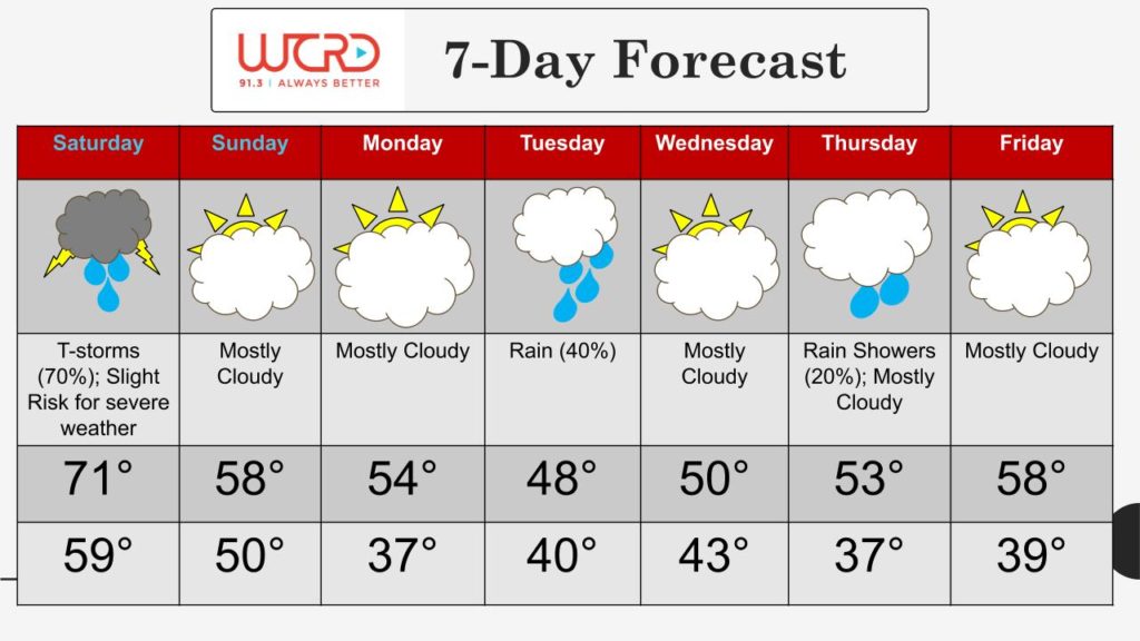
7 Day: As we hop into our 7 day forecast, we can see that tomorrow will be the warmest of the next several days reaching into the lowers 70s, BUT this will come with severe weather which will be mentioned about below. Ending the week, our temperatures will drop into the upper 50s and we might even get into the 60s. Cloudy skies for the next several days and heading into the work week, temperatures slowly drop before rising back up again.
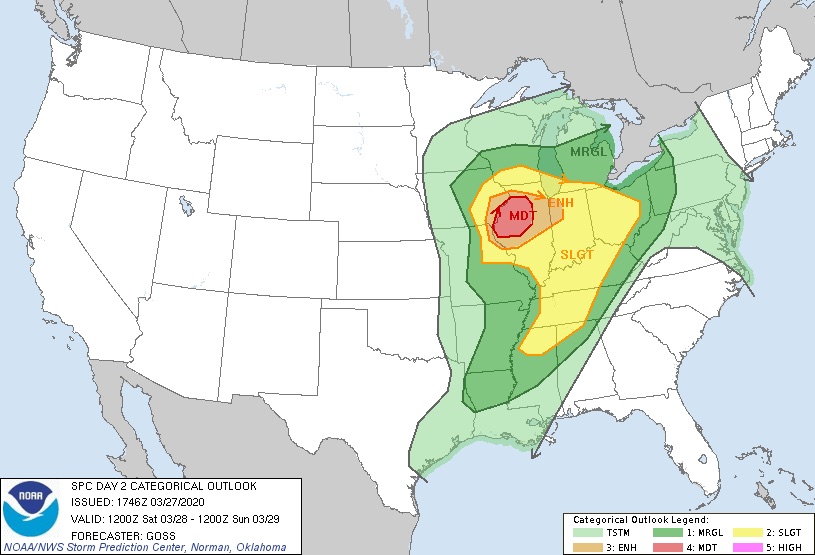
Severe Weather Threat for Saturday: Our eyes are on tomorrow with a great chance of severe weather. We are currently under a slight risk for severe weather for tomorrow. Later tonight, there will be a warm front to pass through during the early morning hours. The setup for these storms will start to initiate around 1pm over in Iowa. This system will slowly start tracking eastward as the day progresses bringing great chances for severe weather including heavy rain, hail and even some tornadoes. We can see chances of the day starting with some isolated showers and some thunderstorms. Throughout most of the entire day, we can expect cloudy skies but there is a chance of some possible clearing around the late afternoon hours. Clearing and daytime heating can bring daytime convection which can make storms a lot stronger. Timing wise of the storms are expected to arrive around the evening hours however, latest models suggest these storms will be fast moving and could arrive in our area earlier.
This will be a great time to start preparing for severe weather to impact the area and this can include getting a emergency preparation kit and having severe weather preparation plan set into place.
A flood watch also remains in effect for all of our viewing area besides Wayne and Henry countries from 12am tonight until 12 pm tomorrow afternoon.
WCRD Weather Forecaster Chris Guevara
![]()