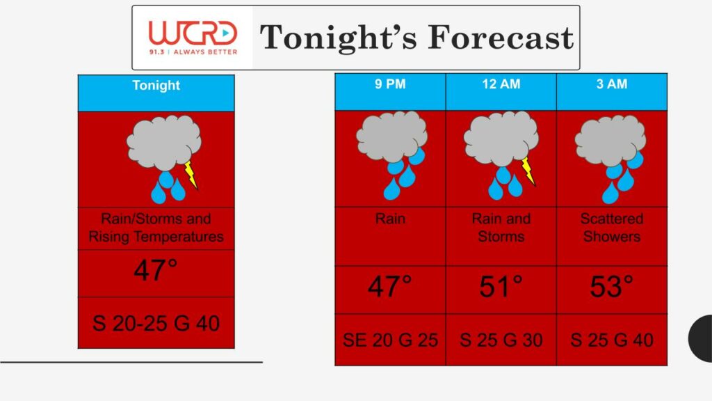
Tonight: Here in Central Indiana, quite an unusual weather scenario is going to play out over the next 12-24 hours. A warm front will pass through in the next few hours, leading to rising temperatures this evening. Temperatures top out at 53 degrees by early Sunday morning. With this warm front comes widespread rain and thunderstorm chances into the overnight hours, with a quarter to a half an inch of rain expected. Rain will make its way into the viewing area by 8pm, so make sure to grab an umbrella and a jacket if you are heading out tonight! Rain chances taper off by Sunday morning. Winds will be breezy out the southwest at 25mph, with gusts up to 35-40mph possible.
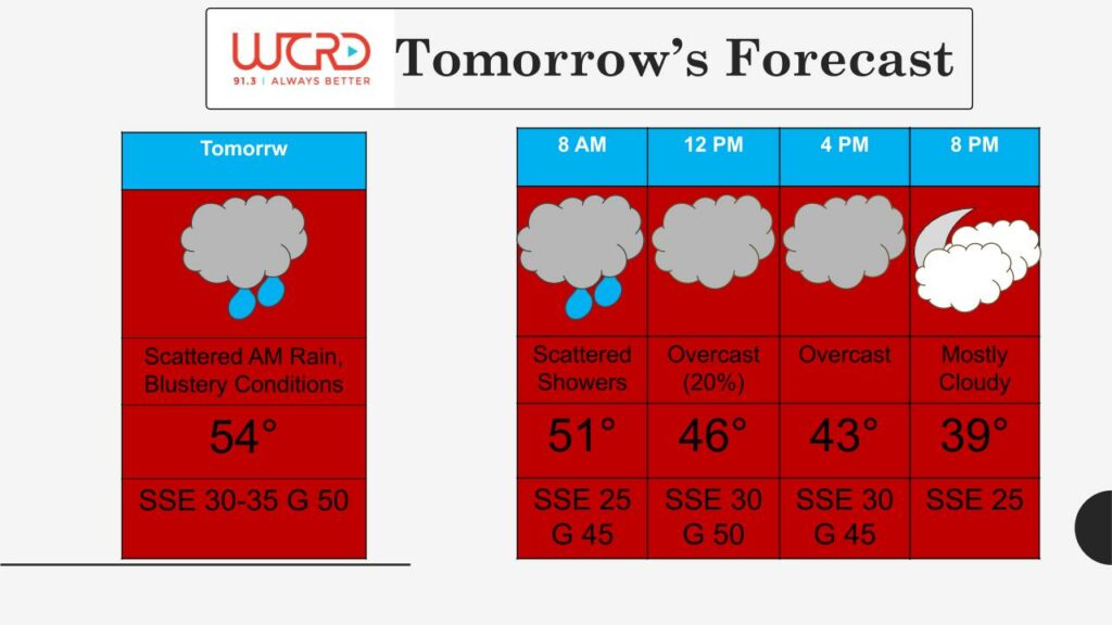
Tomorrow: As we head into Sunday, winds will be the main weather story, with blustery conditions on tap throughout the day, especially between midnight and lunchtime. A strong low pressure system will move through northern Michigan tomorrow, bringing widespread blustery winds to much of the Midwest. There is a Wind Advisory issued via the National Weather Service lasting throughout the day on Sunday, from 1am EST until 7pm EST. Winds will be sustained at 30-35 mph out of the south southeast, with gusts topping out as high at 50mph. Make sure to stay weather aware tomorrow. Take steps to secure any outdoor belongings that can easily be blown about and exercise precaution when driving if you’re heading out during the day. Spotty power outages could be possible, as winds could be strong enough to affect trees and power lines.
As for temperatures on Sunday, we actually reach our high temperature for the day in the early morning hours before sunrise. A cold front will quickly slide through around daybreak, leading to falling temperatures throughout the day tomorrow, from the mid 50s into the lower 40s by tomorrow evening. Rain chances taper off by lunchtime, leading to a dry but overcast afternoon. Tomorrow will be a great day for any indoor activities. If you are planning on heading out, make sure to stay safe and weather aware.
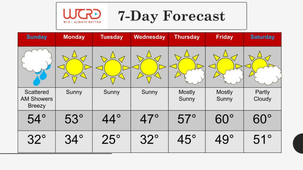
7-day: A system of high pressure moves in on Monday, and it will influence our weather pattern for the rest of the week. Expect plenty of sunshine and dry conditions! We could see a couple mornings of widespread areas of frost early this week, as low temperatures do dip below freezing on both Tuesday and Wednesday. A warm up is expected towards the end of the week, with above-average high temperatures in the upper 50s to near 60.
-Weather Forecaster Maddi Johnson
![]()