
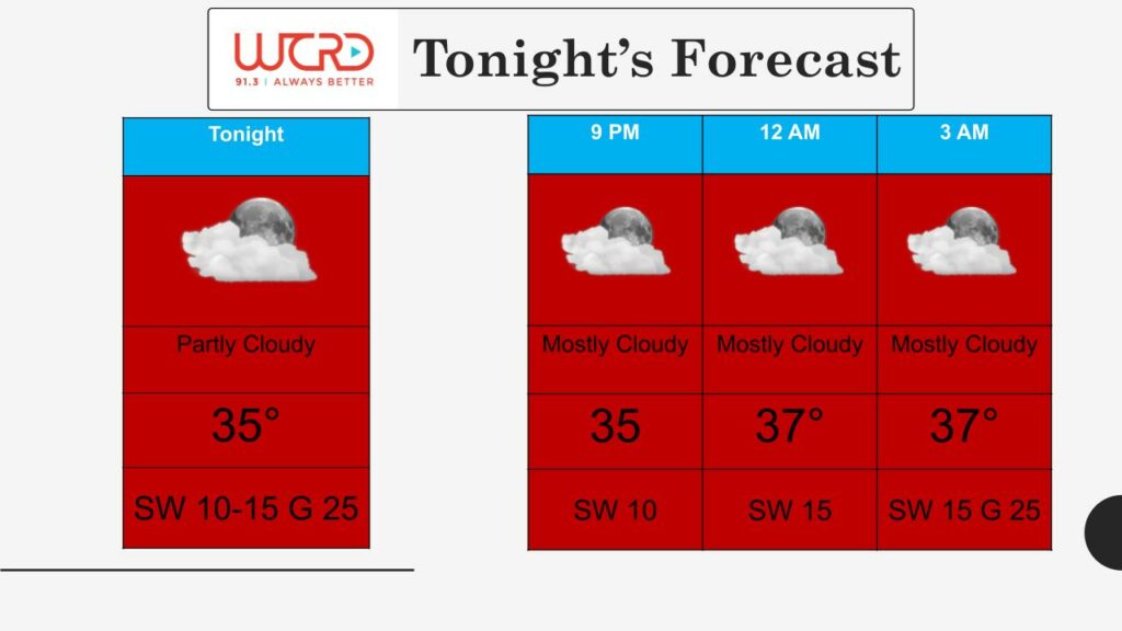
Tonight: Today we saw plenty of sunshine and southwesterly winds, leading to spring-like high temperatures in the mid 40s. Tonight, those southwesterly winds will continue, leading to low temperatures staying above freezing in the mid 30s. Winds will be 10-15mph, gusting up to 25 mph as we get closer to the early morning hours. Increasing cloud cover this evening will lead to partly cloudy skies overnight.
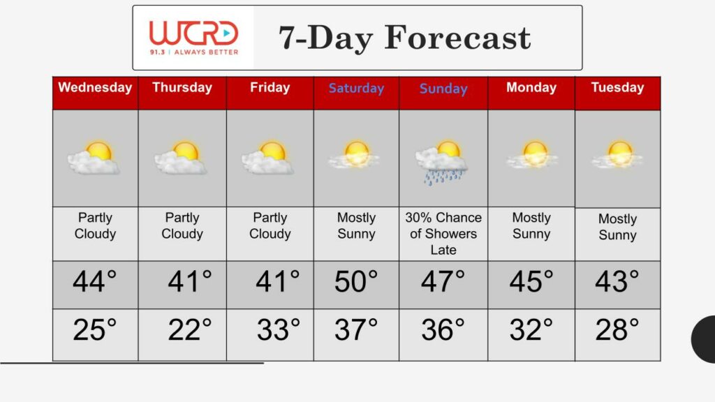
Tomorrow: Starting off the day tomorrow, we could see some patchy areas of dense fog. Take it slow on the roads tomorrow morning for your commute to work or school because visibility could be reduced to as little as a quarter of a mile.
Tomorrow, we will see conditions very similar to today. Temperatures are expected to top out in the mid-40s once again as a result of sunshine and southwesterly winds. Clouds will decrease in the morning hours, leading to a sunny afternoon. Make sure to take your sunglasses with you if you’re heading outside!
7-day: You’ll need the sunglasses throughout the rest of this week as well! Temperatures will be fairly mild, about 5-10 degrees above average for late February. We could reach 50 on Saturday, which would be the first time we’ve seen temperatures in the 50s since December 30, 2020. A chance for rain showers on Sunday evening is the only chance for precipitation in the entire 7 day forecast.
–WCRD Weather Forecaster Maddi Johnson
![]()