
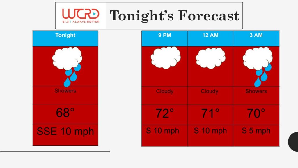
Good evening everyone, a wet beginning to the week, but the coolest air of the season at the end of the week, with highs only in the mid 60s.For tonight showers and thunderstorms continuing with very heavy rainfall possible with a low of 68 degrees with SSE winds at 10 mph.
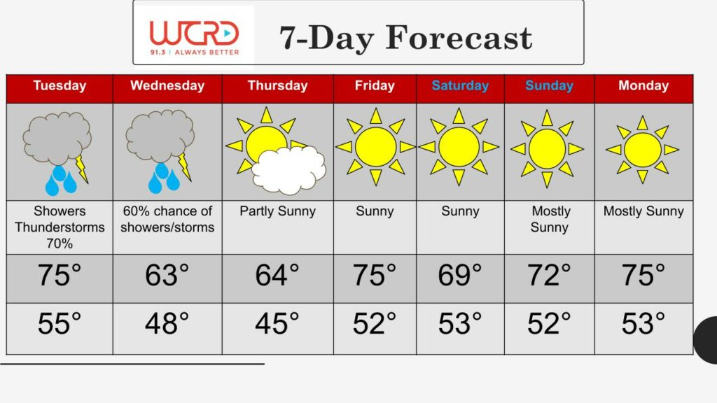
For tonight mostly cloudy with a 30% chance of showers and thunderstorms with a low around 68. South wind around 14 mph, with gusts as high as 23 mph. Tomorrow will be cloudy with showers and thunderstorms, High near 75. South wind 10 to 15 mph, with gusts as high as 20 mph. New rainfall amounts between a half and three quarters of an inch possible. Tomorrow night Showers and possibly a thunderstorm early, otherwise a chance of showers with a low of 55. Some of the storms could produce heavy rainfall. Winds will be out of the North at 10 to 15 mph. Chance of precipitation is 80%. New rainfall amounts between 1 and 2 inches possible. For Wednesday Mostly cloudy with showers a 60% chance of showers with a high near 63. North wind 15 to 20 mph, with gusts as high as 23 mph. Wednesday night Mostly cloudy, with a 40% chance of showers with a low around 45. For the rest of the week we will be dry and unseasonably cool.
![]()