Good Wednesday morning!
Local Weather Update
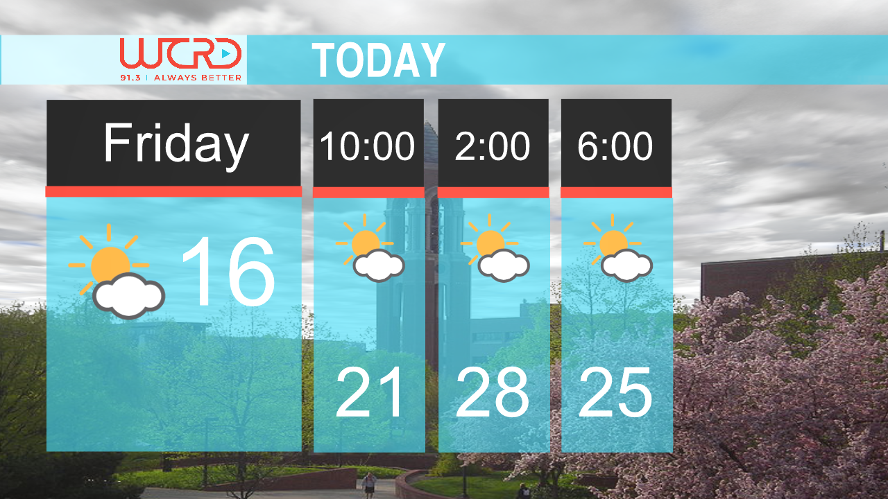
Today, expect temperatures to warm up to only about 53 degrees with partial cloud cover throughout the day. Winds will be out of the northwest at about 10-13 mph. Tonight, skies will be mostly clear and temperatures will drop to around 34 degrees. This could allow for some patchy frost to develop overnight and into tomorrow morning.
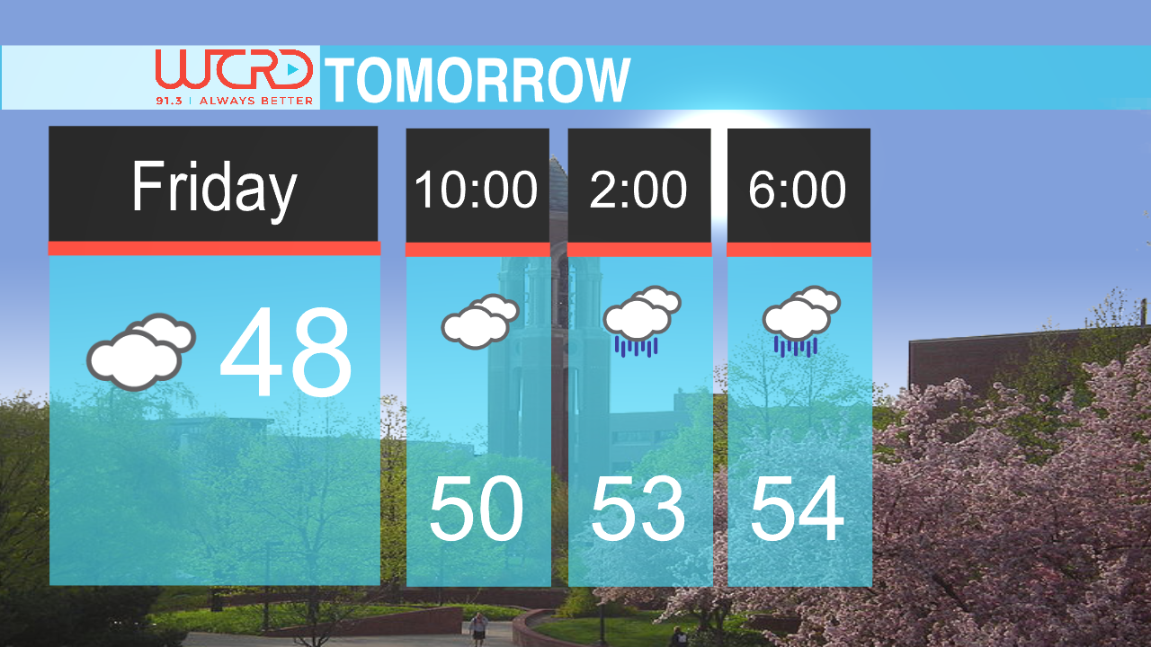
As for the next few days, we will see a big warming trend. Tomorrow the high will be around 60 degrees with sunny skies. Tomorrow night the low will be around 42 with clear skies overnight. Rain chances will return Friday late afternoon and evening. Along with rain chances also comes the chance for a thunderstorm with this system. This system will also bring gusty winds during the daytime Friday and overnight into Saturday as well. Friday temperatures will reach almost 70 degrees with a low of around 61.
Your weekend is shaping up to be a very warm one. Saturday we will see temperatures peak at around 80 degrees with gusty winds and Sunday temperatures will peak at around 81 degrees. Both days we will see a slight chance of showers and thunderstorms but those look to be isolated at this moment. We are hoping the rain stays away so that everyone can enjoy a great weekend outside.
Warming Trend
If you are a fan of warmer weather and those summer-like temperatures on schedule for this weekend, you may like this next piece of weather news.
The Climate Prediction Center issues an 8-14 day Temperature Outlook that shows the likelihood or chance that we will see above average, below average or normal temperatures in the next two weeks. They show that the first week of May our chances of seeing above average temperatures is about 50-60%. This is great news meaning that at least our temperatures for the start of May will be on the warmer side.
Precipitation Statistics
Have you ever heard of the phrase “April showers bring May flowers” That statement seems to be true for us. Within the past few weeks, we have seen a few stationary fronts that have stalled along with low pressure systems as well. Both of these have allowed for the increased rainfall that we have had. To give you some background, a stationary front is basically just warm and cold air fighting back and forth and neither of them overcome each other. This allows for conditions to stagnate and allows for continuous rainfall or cloudy conditions over cities.
Looking at climate statistics, we have gotten a surplus of precipitation already for this month at about 5.99 inches compared to our average precipitation of about 2.95 inches. That is more than 3 inches of a surplus of rain, so I hope we see a lot of flowers and trees blooming throughout the next month.
-Chief Weather Forecaster Rachel Stinger