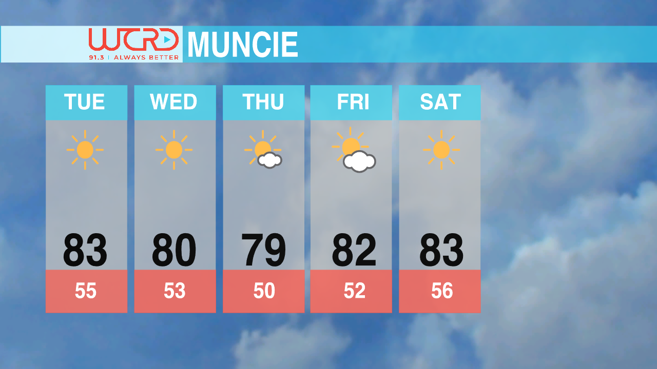
Once again sunny skies and unseasonably warm temperatures are going to plague the area. Highs will be in the upper 80’s today around 88 degrees, with those last bits of summer hanging on. Winds will primarily be out of the northeast at around 5 mph, keeping things light and refreshing. With the inherit lack of moisture in the area, patchy to dense fog is unlikely in most areas. Areas venerable to this, however, include rivers, lakes, and agricultural areas, where the relative humidity is higher than the surrounding area. Lows for tonight will be in the mid 50’s, around 55 degrees, with the lack of cloud cover tonight allowing any diurnal heating to quickly escape out into space.
Temperatures this week will start in the mid to upper 80’s and then start falling off into the mid 70’s as the week progresses. A ridge of high pressure aloft will keep the skies relatively clear with clouds settling into the area throughout the week. Lows are going to be in the mid to lower 50’s, so a sweatshirt or light jacket might be a good idea if you’re going outside after sunset.
-Weather Director Tyler Miller